Walkability model using dynamic multi-layer method in transit hub design in West Jakarta
Details
Publisher
Architecture ITB
Course
Thesis
Advisor
Aswin Indraprastha
Jury
M. Donny Koerniawan; Heru W. Poerbo
Cite
Information#
- Access the full text on this site:
- View the full-text version on ITB’s repository: Full text.
Abstract#
The DKI Jakarta Provincial Government aims to realize a sustainable transportation system in Jakarta, as evidenced by its receipt of the Sustainable Transportation Award 2021 from ITDP. However, over time, Jakarta must enhance its transportation services, particularly in West Jakarta, which serves as an international gateway due to its direct connection to Soekarno-Hatta International Airport, as well as its strategic toll roads and inter-provincial routes, and urban transport facilities such as BRT (TransJakarta), KRL, and MRT. For Jakarta, improving transportation services is critical because inadequate planning could lead to new issues within the urban system, such as congestion, air pollution, and crime. Therefore, the design of an integrated transit hub (TH) connected with public transportation and public spaces (PS) can support SDG Goal 11 and align with government objectives.
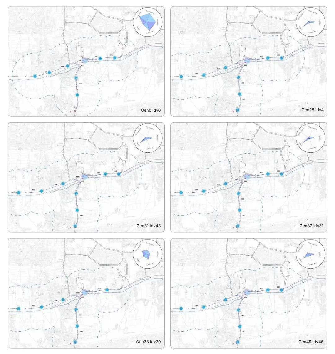
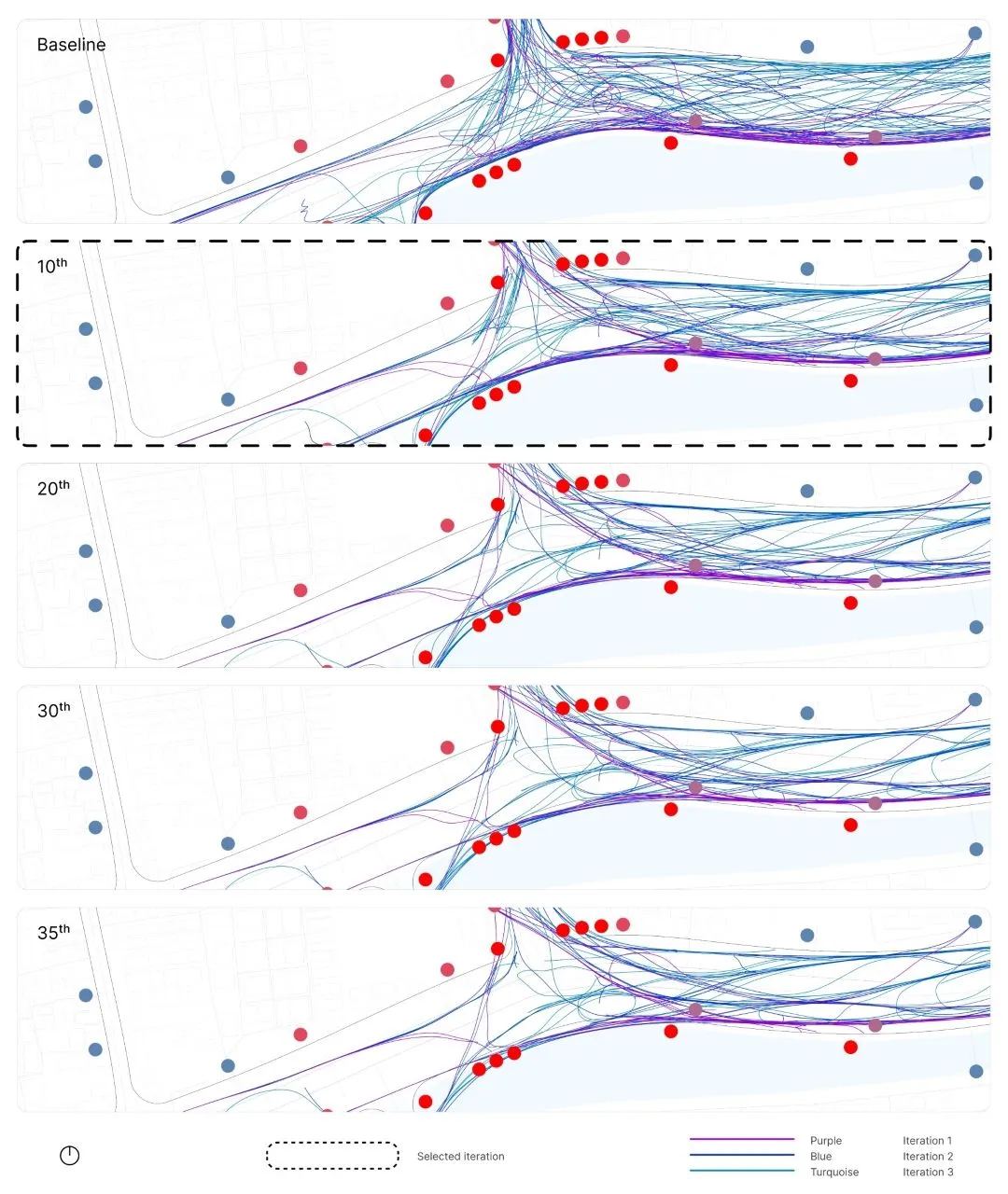
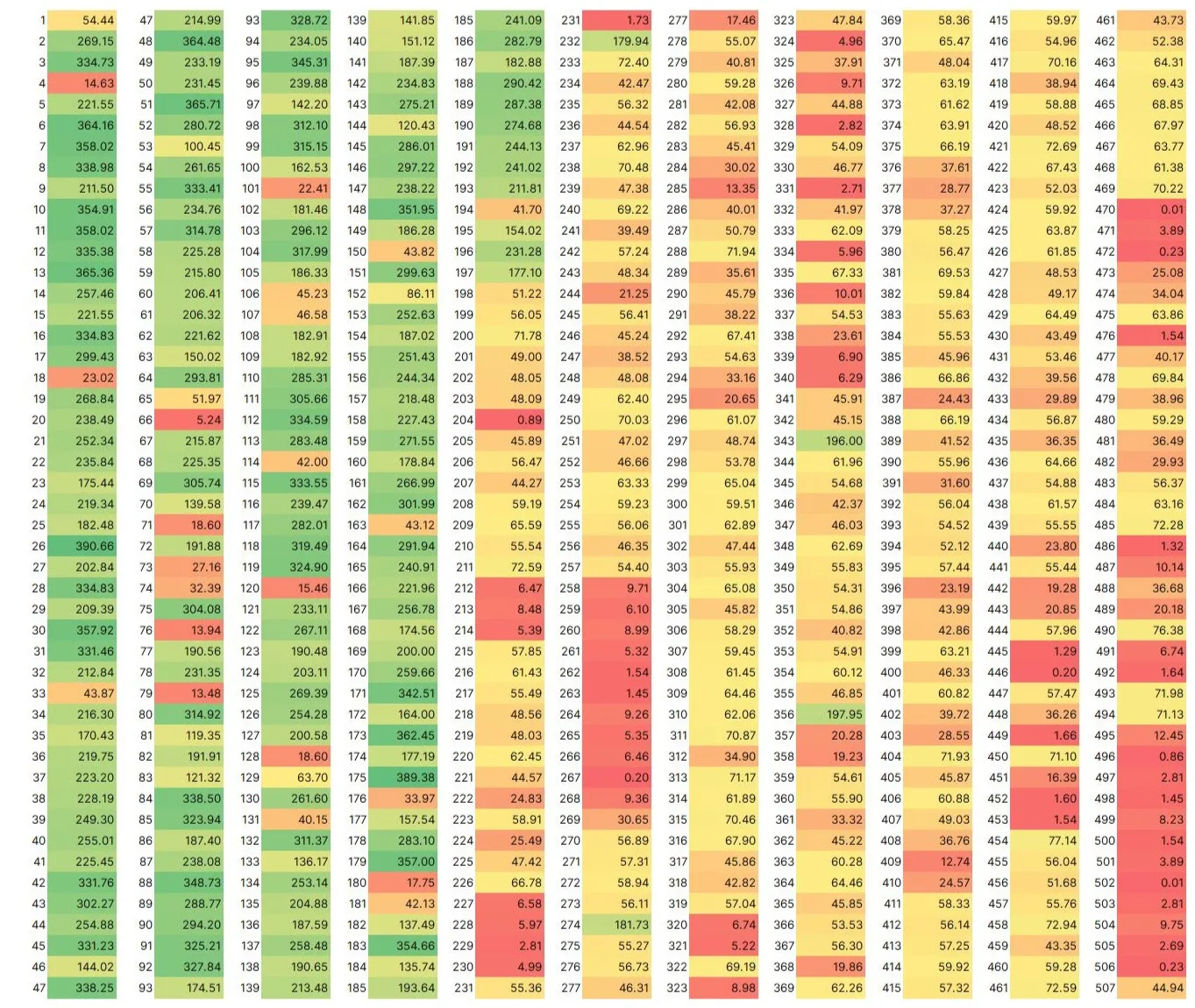
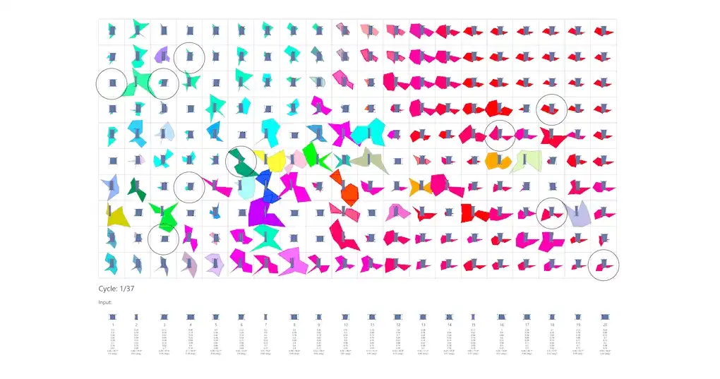
This thesis will explore issues, methods, and solutions to identify critical issues and their impact on the area and site. The dynamic multi-layer (DML) method is employed to address complex problems in the case study, focusing on human movement issues. Each layer utilizes different methods, including: (1) distillation and sub-set data to filter traffic density data for model abstraction; (2) agent-based modeling (ABM) for dynamic human movement modeling; (3) Laplacian smoothing to simplify movement patterns resulting from ABM simulations; (4) shortest path searching using the A-star (SPA+A*) algorithm to generate values on routes with individual costs and speed in simulations on layer 5; (5) multi-objective optimization (MOO) with objectives including: (a) minimizing the average distance between public space coordinates and each primary activity point (T1); (b) minimizing the average distance between PS coordinates and each secondary activity point (T2); (c) minimizing the average distance between PS coordinates and other PS coordinates; (d) minimizing the total area of combined Voronoi radii per 500m from each PS coordinate; and (e) minimizing the total number of PS; and (6) data clustering for decision-making in selecting the most appropriate solution alternatives.
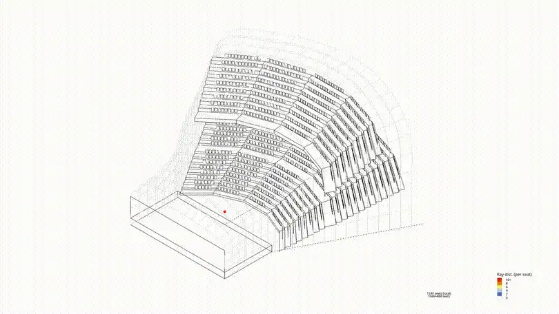
The best solution will then guide the design of TH and PS, including circulation design based on the axis created from SPA+A* route trends and agent characteristics from ABM simulations, as well as the placement of PS based on clustering results from MOO simulations. Guided by the chosen principles, architectural design can accommodate the design aspects, such as mode transfer, pedestrian circulation, platform integration with PS, and supporting functions. The core design concepts are human movement, connectivity, and green space. The design is expected to address the complex issues outlined above and improve the quality of life for local residents.
Keywords#
dynamic multi-layer method; agent-based modeling; shortest path algorithm A-star; Laplacian smoothing; evolutionary multi-objective optimization; data clustering; transit hub; public space
Information#
- Access the full text on this site:
- View the full-text version on ITB’s repository: Full text.
Recent Posts #
WorksBeyond Static
ConceptsNiwakaform

ConceptsWeightless